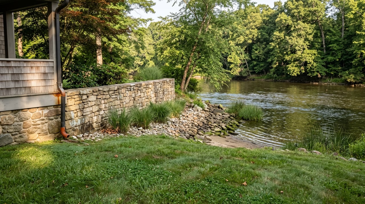
Ask anyone who has spent an August in Great Cacapon how they decide whether today is a river day, and the answer is rarely about the sky. It is about a number. Specifically, it is about the one official reading on the entire Cacapon River, and that reading carries this town's name.
The Only Gauge on the River Shares the Town's Name
The Cacapon runs 81 miles from its underground origins near Wardensville to its mouth at the Potomac, and along that entire length there is exactly one real-time streamgage that paddlers, outfitters, and anyone launching a canoe actually check. It is operated by the National Weather Service and USGS, and it is called, simply, Cacapon River near Great Cacapon.
That matters more than it sounds. A paddler putting in near the Forks of Cacapon, more than 30 miles upstream, is reading the same instrument as a family loading a canoe at the Route 127 bridge just above Largent. The town's name is not decoration on a river map. It is the reference point every serious float decision on the Cacapon runs through.
What the Number Actually Means
The Cacapon Water Trail Guide, produced through WVU's DIY Outdoors program, sets the working rule that most locals already carry in their heads without thinking of it as a rule: the Great Cacapon gauge should read at least two feet for a float to be worth the trip. Below that, you are not paddling so much as dragging.
Trip logs from paddlers who have actually run the river bear this out with more precision than any guidebook. One report from a run on the upper Caudy's Castle section, logged on the afternoon of July 4, 2025, put the gauge at 3.0 feet and falling, described as runnable but on the low side, with the boat scraping bottom more than once. Two older logs from the same stretch, dated September 3, 2021 and September 6, 2021, three days apart, show how fast that number can move: 3.9 feet and falling made for a nice, easy run, while 2.1 feet on the second trip meant scraping bottom the entire way. Half a foot on this river is the difference between gliding and grinding.
Before anyone in town loads a boat, the actual ritual looks something like this:
- Check the Great Cacapon gauge, not a general forecast or last week's memory of conditions
- Pick a put-in and take-out that match the water level, since the upper stretch above the Forks runs Class I-III and the lower stretch is far gentler
- Check hours at whichever store is bracketing that day's run before relying on it as a stop
- Pack for a slower trip than expected, because low water on the Cacapon rewards patience over speed
Thirty-Eight Miles, Bracketed by Two Country Stores
Almost nobody floats the whole river in one day. What locals actually run is a piece of it, and for most people that piece falls somewhere in the stretch from the Route 127 bridge, down past Largent, to the take-out at Great Cacapon itself. That section covers 38 miles of mostly flat, forgiving water, a very different character from the sharper ledges and rapids upstream near the Forks.
Two country stores mark the practical edges of that popular run, and they function less like separate businesses than like the two ends of the same trip. Near Largent, at the upstream edge, Stoney Creek Country Store handles more than sandwiches. For a fee, it will drop off or pick up your boat, which turns the store into an actual piece of river infrastructure rather than just a place to grab lunch. Down at the other end, inside Great Cacapon proper, Doris's Deli & Grocery at 5210 Central Ave opens at 7 a.m. and stays open until 9 p.m. every day of the week, run by Doris Miller and known locally as the spot for breakfast on the way out and dinner on the way back. Between those two stops, the float basically runs itself.
The Landmark Upstream That Lower-River Paddlers Never See
Not every trip on the Cacapon looks like the family float between Largent and town. Farther upstream, near the Forks of Cacapon, the river cuts past Caudy's Castle, a sandstone pinnacle that rises hundreds of feet above the water and has been a landmark since long before anyone thought to put a gauge on the river at all. The rock takes its name from James Caudy, a frontiersman who reportedly used its narrow ledges to fend off pursuers during the French and Indian War.
That stretch runs Class I through III, sharper and less forgiving than the water most Great Cacapon locals float in August, and paddlers there are usually watching for winter and spring runoff rather than summer levels. What ties the two trips together is the same gauge reading. A paddler deciding whether Caudy's Castle is runnable checks the exact same number as a family deciding whether Largent to Great Cacapon is worth the drive. One river, one instrument, two very different days on the water.
Ask five regulars at Doris's what the river is doing on a given morning and you will likely get five different opinions about whether it is worth the trip. All five, though, are looking at the same number.
Two New Names on the National Register, One at Each End of the Run
The stretch most locals actually paddle happens to be bracketed by more than country stores. In September 2025, two bridges spanning the Cacapon in Morgan County were individually listed on the National Register of Historic Places within the same announcement, a rare distinction for a county this size. One is the 1916 Daniel Luten Concrete Arch Bridge at Largent. The other is the 1937 Parker through-truss bridge that carries WV Route 9 over the Cacapon at Great Cacapon, near where the river empties into the Potomac.
That second bridge has a name most locals already know. In June 2024, it was formally dedicated as the Thurman W. Whisner Memorial Bridge, after a man born on a farm near Great Cacapon in 1951 who joined the state highway department as a bridge inspector in 1969, graduated from WVU Institute of Technology in 1974, and spent from 1979 until his death in 2022 living in Great Cacapon while working as a structural engineer for the state. The bridge you paddle under to finish a float here was, for more than four decades, the exact kind of infrastructure the man it is named for spent his career making sure held up. A West Virginia Press Association account of the listing quotes the researcher behind the nomination noting that only 34 bridges statewide had previously earned a spot on the National Register, which makes two more from one county a genuinely rare cluster.
So the popular stretch of river that most Great Cacapon residents actually float starts near a store with a boat shuttle, runs 38 miles through country that barely changes from one summer to the next, and ends by passing under a bridge named for a neighbor whose life's work was exactly the kind of engineering that just earned it a place in the national record.
The Same River, Measured Once
None of this shows up if you are just looking for things to do near Great Cacapon. It shows up only if you already live close enough to know that the town's name is on the instrument the whole river depends on, that the float most people take is the one between two specific stores rather than the whole 81 miles, and that the bridge marking the end of that float is now part of the same historic record as the one 20 minutes upstream near Largent. That is not a list of attractions. It is how a place actually gets read by the people who live in it.
That kind of detail, the kind that only comes from paying attention over years rather than skimming a map, is the same instinct Kesecker Realty, Inc. brings to every conversation about property in Morgan County, whether the question is about a float plan or a floor plan. Contact a local agent today.